#Geograph Picture of the Day #POTD from Co.Antrim, 2010
#Lighthouse #Whitehead #Ireland #NI #Antrim #stormlight #Photography geograph.ie/p/1885914
Free to share – please credit Albert Bridge/Geograph


#Geograph Picture of the Day #POTD from Co.Antrim, 2010
#Lighthouse #Whitehead #Ireland #NI #Antrim #stormlight #Photography geograph.ie/p/1885914
Free to share – please credit Albert Bridge/Geograph
#Geograph Picture of the Day #POTD from #Northumberland, 2006
#Bedlington #bridge #River #Blyth #frostymorning #weather #photography #landscape #frost
https://geograph.org.uk/p/115619
Free to share – please credit Chris Tweedy/Geograph
The Geograph project is entirely volunteer owned and run, and depends only upon personal donations. Visit https://www.geograph.org.uk/help/donate
"Since 2005, 13,982 contributors have submitted 7,972,008 images covering 282,959 grid squares, or 85.2% of the total squares"

Stickman, Tullycunny, taken Wednesday, 25 September, 2024
cc-by-sa/2.0 - © Kenneth Allen - geograph.ie/p/7885801
6 km SW of Omagh, Co Tyrone

#Geograph Picture of the Day from #Cambridgeshire 2017 #POTD #England #photography
#Whittlesey #StrawBears #dancing #festival #MorrisDancing #folklore
Https://geograph.org.uk/p/5257372
Free to use – please credit Richard Humphrey/Geograph
The Straw Bear dance is an old local tradition, revived in its modern form in 1980, and is now the focus for a large festival of Morris dancing, with around 30 troupes performing

#Geograph Picture of the Day from #Northumberland 2023 #POTD #England #photography #marine
#conservation #seacreatures #shelter #intertidalzone #Blyth #Photography
Https://geograph.org.uk/p/7745427
Free to use – please credit 'Leanmeanmo'/Geograph
"Looking like exotic fruits, these homes for small marine creatures hang in the intertidal zone."

#Geograph Picture of the Day from the #Highlands, March 2024 #POTD #Scotland #ShipWreck #photography
#wreck #GoldenHarvest #Corpach #LochLinnhe
Https://geograph.org.uk/p/7825804
Free to use – please credit AlastairG/Geograph
Launched in 1975 as the Dayspring, it was later renamed the Golden Harvest. After a very varied career in locations in Scotland and Ireland, it ended up being moored in Camusnagaul Bay on Loch Linnhe. In 2011 a southwesterly storm caused its moorings to fail and it was blown ashore near the opening to the Caledonian Canal near Corpach.

#Geograph Picture of the Day from #Cambridge 2023 #POTD #Autumn
#CherryHinton #suburbia #trees #LeafFall #busstop
Https://geograph.org.uk/p/7649532
Free to use – please credit John Sutton/Geograph
Looking towards Lichfield Hall from the city-bound bus stop near the Cherry Hinton Road end of Lichfield Road in the middle of a November Sunday.

@thisismyglasgow
2011 view
https://www.geograph.org.uk/photo/2465682
#geograph
Close up of red sandstone building , numerous windows, one broken
I like this one, it speaks of our times.
Floodwater around Worcester's Southern Relief Road
cc-by-sa/2.0 - © Philip Halling - geograph.org.uk/p/7680655
#Worcester #Flooding #RiverSevern #newyear2024 #Geograph

A standing stone in a sunny, heathery clearing with young Sitka spruce as a background.
Stained Glass, Denton Magistrates' Courtroom (GMP Museum)
cc-by-sa/2.0 - © David Dixon - http://geograph.org.uk/p/3954249

"Blackfriars Railway Bridge"
cc-by-sa/2.0 - © Wayland Smith - https://geograph.org.uk/p/2995612
Dominating the foreground is a brightly coloured decorative feature portraying the arms of the London, Chatham and Dover Railway, who built the bridge, and the monogram of Queen Victoria with the date 1867. This cast iron carries the legend "Invicta", the county legend of Kent, from whence the trains come.

Intertidal Sand patterns, all cc-by-sa/2.0 - © Mr T (at #Geograph). All photographed within a few metres of each other on Lytham st Anne's beach.
"Honeycomb Sand" - https://geograph.org.uk/p/652440
"Waves in the Sand" - https://geograph.org.uk/p/652435
"Erratic Sand" - https://geograph.org.uk/p/652449
"Sand Hills" -
- https:// geograph.org.uk/p/652443
#Photography #Beach #Sand #LythamStAnne's #Lancashire #UK #Geolocation


One of mine:
"Manchester Sunrise"
cc-by-sa/2.0 - © Bob Harvey - https://geograph.org.uk/p/7604239
The brightness of sunrise is shining through the arch from a very low sun, while most of the sky is filled with a haze

@junesim63
A #Geograph contributor documented the mishandling of Covid 19 in real time and 2020 and the elevated casualty numbers. Bullying from The Party (internally) saw this removed and lost. The contributor walked. This was justified by "impartiality".
I like the name.
Boundary stones or markers are quite common remnants of the world before accurate mapping. This one also marks the boundary between Lancashire and Yorkshire, an important distinction.
"Boundary stone, Turvin Road B6138, Mytholmroyd"
cc-by-sa/2.0 - © Humphrey Bolton - https://geograph.org.uk/p/843397
#Geograph #Photography #Yorkshire #Lancashire #Boundary #Geolocation #Mytholmroyd #Moorland #Uplands
See https://en.wikipedia.org/wiki/Mytholmroyd for pronounciation.

See Also
"View north to Minninglow Hill"
cc-by-sa/2.0 - © Colin Park - https://geograph.org.uk/p/3283166

#Geograph #POTD #PictureOfTheDay today
"Minninglow Hill Summit"
Low sun across Minninglow Hill in January 2009
cc-by-sa/2.0 - © Richard Bird - https://geograph.org.uk/p/1194536


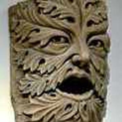
 James Allan
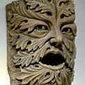