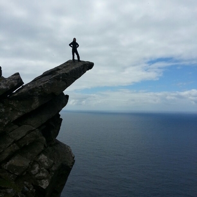
WebODM auto-align feature - looks pretty neat, this software is amazing
Recent searches
Search options

#WebODM
0 posts0 participants0 posts today

OpenDroneMap/WebODM
V2.7.2
---
- Add user search
- Add hosted instance link alert
- Add 172.16 /12 as Private IP Range
- Fix thermal layer name in project map view, add compact feature, onboarding settings
---
OpenDroneMap/WebODM
V2.7.1
---
- Update README.md
- Geolocation file download, task thumbnails, task alignment support
...
---
GitHubRelease 2.7.1 · OpenDroneMap/WebODMWhat's Changed
Update README.md by @chrisgla in #1611
Geolocation file download, task thumbnails, task alignment support by @pierotofy in #1615
New Contributors
@chrisgla made their first contri...
OpenDroneMap/WebODM [Windows native]
v2.7.0 Build 111
---
- Update WebODM to v2.7.0 (main)
- Update NodeODM to v3.5.4 (tag)
---
OpenDroneMap/WebODM
V2.5.7
---
- Add full screen button to plot gps map view
- Add warning message when 999 images are selected
- Dronedb plugin fix
- Handle import chunk retries
- Reduce memory usage in DEMs rasterization
- More memory optimizations for RGB/HSV conversion, duplicate filename uploads
- More consistent hillshading across zoom levels
- JS bundle optimization, placeholder loading screens
...
---
GitHubRelease 2.5.7 · OpenDroneMap/WebODMWhat's Changed
Add full screen button to plot gps map view by @pierotofy in #1574
Add warning message when 999 images are selected by @pierotofy in #1577
Dronedb plugin fix by @HeDo88TH in #1576
H...
OpenDroneMap/WebODM
V2.5.6
---
- group installations instructions
- Update README.md
- feat: instructions of GPU acceleration
- unitBackward fix
- Create BIGTIFF output during export if needed
- Hide Add Project button when user doesn't have permissions
- Public edits
- Links for 3D meshes support
...
---
GitHubRelease 2.5.6 · OpenDroneMap/WebODMWhat's Changed
group installations instructions by @sbonaime in #1544
Update README.md by @NtskwK in #1548
feat: instructions of GPU acceleration by @NtskwK in #1549
unitBackward fix by @pieroto...


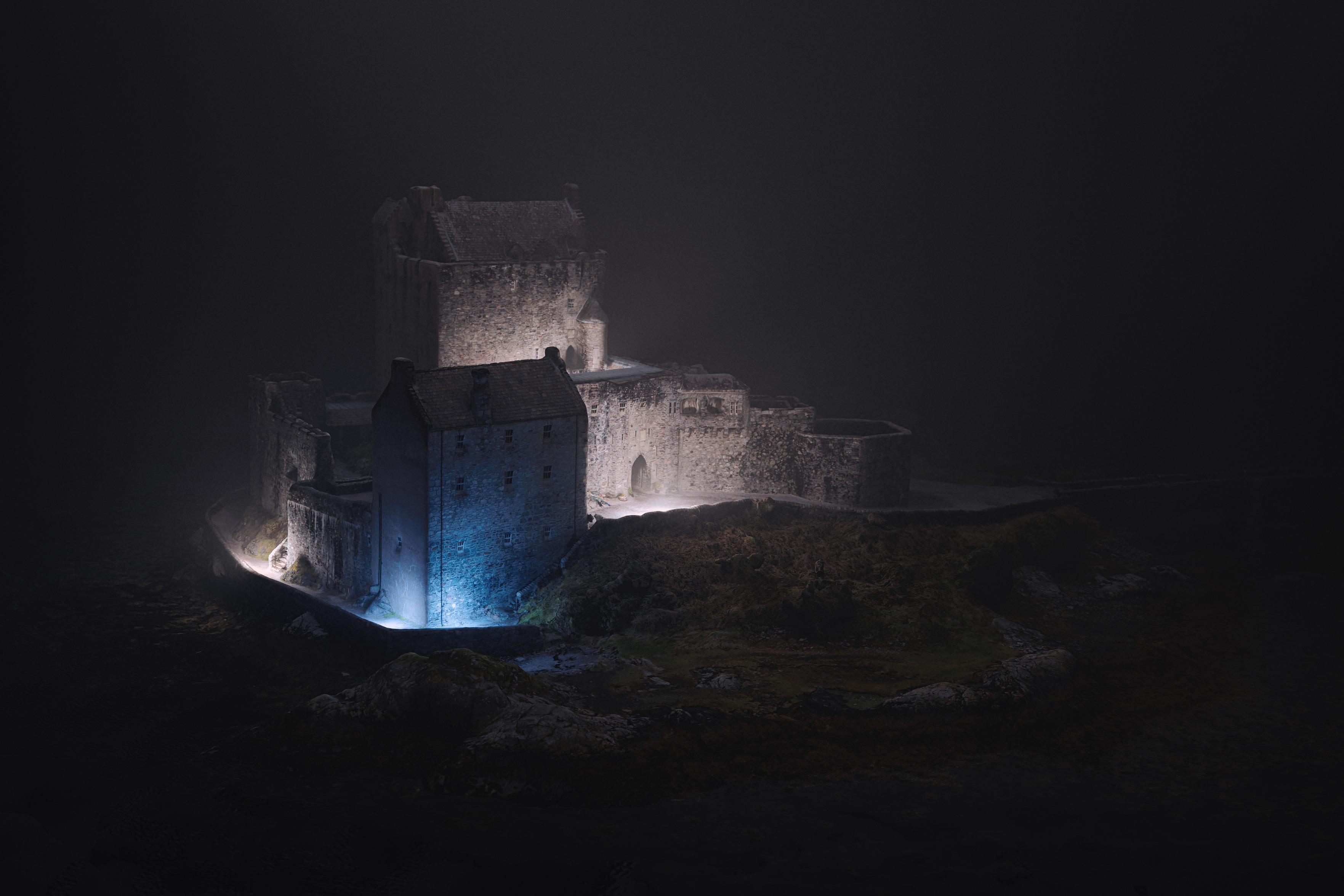
Eilean Donan
The cliché of castles, but I think I've made a distinctive photo of it.
200 frames from all around shot on the droneybird, processed in WebODM, re-lit and camera parameters chosen in Blender and finished in Luminar Neo.
Prints, cards and more via the website: https://shiny.photo/photo/Eilean-Donan-2d46ad8e4088e90fb041e64a5bc486a7
#photography #photogrammetry #3d #blender #scotland #castle #landscape #fog #night #highlands #WebODM @OpenDroneMap
Heritage in Tarmac
A tribute to a favoured old road - three fragments of the historical Devil's Elbow route through Glenshee presented as a triptych.
I flew the droneybird up and down over a mile of the A93, used #WebODM to build a 3D model of the glen, Blender to compose and relight each frame consistently and finished in Luminar Neo.
#photography #photogrammetry #Blender #art #scotland #road #heritage #perthshire @OpenDroneMap

OpenDroneMap/WebODM
V2.5.4
---
- Add temperature units support
- fix: add blank=True to plugindatum's user field
- Use StreamingHttpResponse when downloading zip streams
...
---
GitHubRelease 2.5.4 · OpenDroneMap/WebODMWhat's Changed
Add temperature units support by @pierotofy in #1521
fix: add blank=True to plugindatum's user field by @samul-1 in #1523
Use StreamingHttpResponse when downloading zip streams by @...
OpenDroneMap/WebODM
V2.5.3
---
- Update README.md
- Notify that we are resizing images
- Improvements to Units support
- Fix layer panel scrolling
- Update README.md
- Fix unit selector background color
- Add task backup import/export
- Fix hard recovery script
- Add GPS location plugin
- Mobile improvements
- Add restart confirmation
- Update OpenStreetMap provider
- Improved Thermal Support
...
---
GitHubRelease 2.5.3 · OpenDroneMap/WebODMWhat's Changed
Update README.md to reflect no gitter by @smathermather in #1502
Fix #1505 add a signal to notify that we are resizing images by @diegoaces in #1506
Minor improvements to Units supp...
Here's an annoying one - we took some drone imagery of a Black Headed Gull colony to help count the chicks. This is a really difficult and disruptive thing to do on foot, so using the drone would be great - except the chicks move!
The first two images are from the raw photos, taken 10s apart on adjacent transects. The final is a clip from the stitched ortho.
I'm not sure there's any way round this?


OpenDroneMap/WebODM/All Platforms:
WebODM (v2.5.2+)
There is currently a bug that will cause an empty white page to be displayed when interacting with the Cloud Import and DroneDB Import functions on the Projects and Tasks view.
These plugins are disabled by default, so this should only impact folks who have explicitly enabled these plugins.
The cause of this issue is being investigated.
GitHubPossible Bug: Cloud Import / DroneDB Import Buttons Break UI · Issue #1477 · OpenDroneMap/WebODM
OpenDroneMap/WebODM [Windows native]
v2.5.2 Build 105
---
- Update WebODM to v2.5.2 (main)
- Update NodeODM to v3.5.1 (tag)
---
.
Beneath it reads Launching processing node...
On the bottom right, it is labeled as version: 2.5.2 build 105.")
It's been years since I visited Balvaird Castle on the edge of Perthshire. A definite favoured spot to fly the droneybird too.
First of these is a 3D model, rendered in Blender. All finished in Luminar Neo.


Photogrammetry meets art again.
I've liked this view of Amulree and Strathbraan Church from the Glen Quaich road for many years, but always thought it best from a slight elevation.
So the "closeup" photos are from a 3D model - 262 * 48MP = 12Gpx of source images (DJI Air3), built using WebODM, re-illuminated and rendered in Blender and finished in LuminarAI.
Wide-angle shot for context.
#Perthshire #drone #photogrammetry #photography #Scoltand #Church @OpenDroneMap #WebODM #OpenDroneMap


#OpenDroneMap I ran 900 images using split-merge on my local PC, but despite setting the GSD to 0.6 (same as the imagery) the resolution is notably worse than when I ran the same images through WebODM Lightning. Can anyone suggest what I need to tweak?
The only other settings changed from default were Fast-orthophoto and skip-3dmodel


#WebODM I've installed WebODM and got it working on my desktop and I'm keen to try a larger dataset using split-merge. Has anyone got a nice tutorial for this? I'm a bit confused by how much overlap I should set
Craignavar Deserted Township, Glen Almond
Comprising the stone ruins of at least 22 rectangular buildings and a corn-drying kiln with associated stone-walled enclosures and fields, Craignavar was deserted in around 1820. It's unknown whether it was part of the forced Highland Clearances or just a voluntary departure due to economic reasons.
Prints, cards etc via the website: https://shiny.photo/photo/Craignavar-Deserted-Township--Glen-Almond-fe9cbc8eec03195d00819070de1f9cd6

OpenDroneMap/WebODM
V2.4.2
---
- Add --worker-cpus option
- Update PyODM
- Upgrade to Node 20
- Update README.md
- Remove django-compressor
- Fixed typo in README.md
- Fix error shadowing in log when plugin fails to load
- Add task ID to expanded list item
- Fix user-facing misspelling, improve a few user-facing strings
- Automatically select 2/98 percentile values in plant health
- Ability to share particular map type
---
GitHubRelease v2.4.2 · OpenDroneMap/WebODMWhat's Changed
Add --worker-cpus option by @pierotofy in #1443
Update PyODM by @pierotofy in #1447
Upgrade Node 14 to Node 20 by @chris-bateman in #1439
Update README.md by @douw in #1458
Remove d...
Tullibardine Chapel
Some people would take a photo.
I shot 156 * 48MP = 7.3Gpx of data, used WebODM to build a 3d model and rendered it at 8k resolution with moody lighting in Blender, as one does.
(Final toning / colour-grading & vignette in LuminarAI, just for completeness.)
